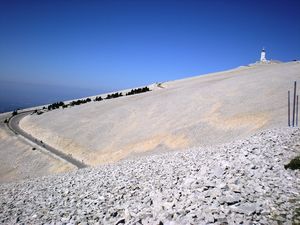
It is an unmissable ! The legendary Mont Ventoux is a challenge for well-trained cyclists : At 1909 metres of altitude the 360 degrees panorama is breathtaking. The absence of vegetation and the omnipresence of limestone inspire and surprise. "Bare", "lunar" are just so many descriptives to qualify the bald mountain. It is THE mythic mountain of Provence, renowned above and beyond our area.
Be sure to be well prepared for the intense effort ahead of you !
The climb from Bedoin
Distance : 21,8 km (13,55 miles)
Elevation gain : 1598 m (5243 ft)
Mean slope : 7,5% (passages at 15%)
Duration : from 1h to 3h30
Difficulty level : Extreme
Possibility to warm up from Carpentras, Mazan or Malaucène via col de la Madeleine.
The climb from Malaucène
Distance : 21km (13 miles)
Elevation gain : 1575 m (5167 ft)
Mean slope : 7,5 % ( passages at 15%)
Duration : from 1h to 3h30
Difficulty level : Very difficult
Possibility to warm up from Vaison la Romaine
Weather forecast at the summit
It can get very chilly on the top of a slope, even in summer.
In order to be prepared to the temperatures and the speed of the wind, do not forget to check out the weather conditions on meteo-ventoux.fr that gives you real-time information !
The climb from Sault
Distance : 25,6 km (16 miles)
Elevation gain : 1210 m (3970 ft)
Mean slope : 5% (passages at 10%)
Duration : from 1h to 3h30
Difficulty level : Difficult
Possibility to warm up from Villes-sur-Auzon via the gorges of the Nesque and Monieux. The climb from Sault has no major difficulties except the final 6kms between Chalet Reynard and the summit, very difficult.
