Walks around Malemort du Comtat
Malemort du Comtat is an attractive village ideally situated at the end of the Nesque Gorge and between Carpentras and the Monts de Vaucluse. A perfect spot for discovering the area by foot.
- The Gardy Route : starting from the Salle des Fêtes (village hall), on this walk you will discover ‘bories’ (dry stone shelters) and the local countryside.
Length : 3 ½ hours. Distance : 8,5 km/5,28 miles. Ascent : 220 m/722 feet.
See the details here
- Les Platrières : starting from the Salle des Fêtes (village hall), this walk combines countryside, woods, gypsum quarries and stunning views of the valley.
Length : 4 hours. Distance : 10 km/6,21 miles. Ascent : 270 m/886 feet.
See the Platrières walk
- The Garriguette Bories (dry stone shelters) : from the car park next to the mairie (town hall) in Malemort du Comtat. You will discover none less than 21 ‘bories’ on this pretty and easy walk. The main difficulty on this walk is keeping to the path when the vegetation becomes a bit dense. We suggest you keep your eyes on the map.
Length : 2 hours. Distance : 4,5 km/2,8 miles. Ascent : +- 105 m/344 feet.
See the route here, jpg, 6.77mo
Walks around Mormoiron
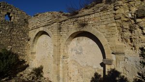
- Gypsum and the Saint Alban Chapel at Mormoiron
A short walk above and overlooking the village of Mormoiron.Views of the plain between Mormoiron and Bédoin with the Mont Ventoux as a backdrop.
Waymarks- yellow paint – PR.
Start/Finish : Car park in front of the post office – Circular walk – Length : 2 hours – Distance : 4,7 km/2,92 miles – Difficulty : Easy – Ascent : 350 m/1148 feet.
Download the route here., pdf, 181ko
- The Ochre at Mormoiron
Discover the Marquetton Valley, the Sitos Ravine and the Naye Valley, splendid ochre red mini canyons.
Start/Finish : Car park at the Salettes Lake (Plan d’eau) - between the restaurant and the treetop adventure park.
Circular walk – Length : 3 ½ hours – Distance : 9,7 km/6,03 miles – Difficulty : Medium – Ascent : 290 m/951 feet.
Download the circuit here., pdf, 1.45mo
Walk – The 3 Chapels
Between Mazan and Mormoiron, amongst the vines and olive trees. Discover the local countryside and its history thanks to the three medieval chapels passed on the route.
Start/Finish : Place du 8 Mai at Mazan - Length : 3 hours – Distance : 9,7 km/6,03 miles – Difficulty : Medium – Ascent : +200 m/656 feet.
Download the GPX on IGN Rando
Walk – ‘Sentier du Petit Patrimoine Rural (rural heritage) at Caromb’
Within the ENS reserve of the Paty Hills, this heritage trail is a testament to the endurance essentiel to survive in the past, no longer present in todays society.
Up until the mid XXth century this now wooded area was cultivated and grazed by flocks. Today the remaining dry stone shelters that can be seen are evidence of this agricultural activity. These dry stone features are part of the municipal and private heritage : no climbing on the stone walls and shelters, stay on the marked paths, no smoking.
To see : Dry stone shelters, Paty Lake, Paty Chapel
Length : 2 hours - Difficulty : Easy - Ascent : +160 m – Distance : 4,5 km/2,8 miles Waymarkings : Dark green
Discovery trail of the Pré Fantasti Manor at Caromb
Within the ENS reserve of the Paty Hills this discovery trail will lead you to the Paty Lake via the Pré Fantasti Manor with its history and legends. A walk with mediterranean grassland, local cultures (olives and figs) and traces of the old stone quarries.
Length : 2 hours – Distance : 3,6 km/2,24 miles – Ascent : 133 m/436 feet.
Download the route here, pdf, 12.32mo